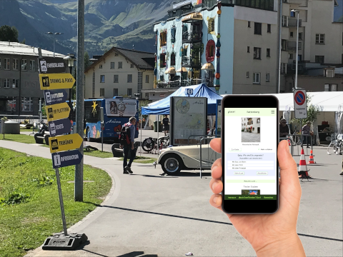
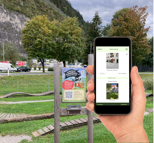
placeit communication
With our communication solution, you can provide visitors, participants and guests with map-based information. You can present your local service providers and draw your visitors' attention to places of interest. And you can use gamification with collectible images and quizzes to make your messages more engaging
And this is the range of functions:
- Playing out points, Routes or areas as locations in a modern offline-capable WebApp
- Location function for quick orientation
- Gamification offers with collectible pictures, Quiz questions or time-controlled collecting
- QR codes or geo-locations for interaction
- Map for clear presentation of all available locations
- List view of all locations for quick orientation across the entire range
- WebPush messages possible
- Personalization options
Easy and intuitive data management via a web application directly in the browser:
- Create and change locations, insert images and text
- Link locations, to make recommendations
- Set up and manage quizzes and scrapbook albums
- Communication via WebPush possible
- Statistics on usage
- Delegation of the management of locations
- Management of multiple projects possible
placeit communication can be fully integrated into our planning solution and can use the same data. We have created placeit All in One as a product for this purpose
pET for communicating
- 200 GeoItems
- 1 project
- 1 user
Communication Starter +
- Texts
- Categories
- 350 GeoItems
- 3 Projects
Communication Basic +
- Gamification
- 5 users
- 10 projects
- 500 GeoItems
Advanced communication +
- WebPush
- Salespoints
- 15 users
- any number of GeoItems
Communication Premium +
- any number of users
- any number of projects
placeit planning
Our map-based planning and organization solution supports you in all phases of preparation and implementation. You can easily place points, routes and areas, use ready-made shapes and your own icons to work faster and export lists of required parts. Various maps are available to make planning really precise. And you can control your helpers, distribute tasks and track vehicles in real time.
And this is the range of functions:
- Capture points, routes or areas on a map

- Precise positioning in the terrain
- Use of official maps and special maps possible
- Multiple maps can be superimposed
- Prefabricated or own icons to extend the display
- Shape-Editor for creating reusable templates
- Capture additional information via freely definable fields
- Information on lengths, Areas and perimeters of objects
- Length measurement function on the map
- Output all captured objects in tabular form
- Export of data for spreadsheet programs (CSV)
- Programs (CSV)
- Import and export geodata (e.g. for GPX tracks)
- Categories, Projects and areas to organize the data
- Extensive user management to control permissions
- Assignment of tasks to helpers, partners and employees
- Status monitoring of tasks
- Control of helpers
placeit map planning
- 200 GeoItems
- 1 project
- 1 user
Planning Starter +
- Categories
- Areas
- Shapes
- 350 GeoItems
- 3 Projects
- 5 Users
Planning Basic +
- List view
- Custom icons
- Fields
- 1000 GeoItems
- 10 projects
- 15 users
Advanced +
- Task management
- KML export
Premium + unlimited
- GeoItems
- Projects
- Users
placeit All in One
Do you need everything? Then our all-in-one solution is right for you. You combine everything you have recorded in the planning and preparation with the possibilities of communication. This allows you to quickly and easily determine where your visitors can best see, where your participants can receive information and where the catering takes place. Everything from a single source - All in One.
Map-based planning and communication
- 200 GeoItems
- 1 project
- 1 user
Starter +
- Texts
- Categories
- Areas
- Shapes
- 350 GeoItems
- 3 Projects
- 5 Users
Basic +
- Gamification
- List view
- Custom icons
- Fields
- 1000 GeoItems
- 10 projects
- 15 users
Advanced +
- Webpush
- Salespoints
- Task management
- KML export
- Unlimited GeoItems
Premium +
- unlimited products
- unlimited users
If you need a more individualized combination, you can also use our product configurator to create a tailor-made offer for you.